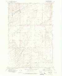
1972 Map of Ralston
USGS Topo · Published 1974About this map
Ralston serves as the focal point of this agricultural landscape in the early 1970s, where the Chicago Milwaukee St Paul and Pacific railroad tracks bisect the terrain. The town's economic reliance on wheat and rail transport is evident through the presence of Grain Elevators, a Water Tank, and the Grange Hall. Beyond the settlement, the geography is defined by broad topographic features like the Flat and the Rattlesnake region, interspersed with a grid of rural routes such as Providence Road and Lind Road. Family history is anchored at the Bemis Cemetery, located near Klein Road. The numerous wells and Borrow Pit excavations across the quadrangle suggest a landscape carefully managed for water access and material resources to support the isolated farmsteads and transport corridors.
Find a feature on this map
28 named features on this map. Tap any name to fly to it.
Don’t see what you’re looking for? This feature index may not catch every label — zoom into the map to look around manually.
Map Details
Editions of this 1972 Ralston Map
2 editions found
Other maps of this area

1923 · Washtucna
USGS Topo · 1:62,500

1925 · Washtucna
USGS Topo · 1:62,500

1950 · Benge
USGS Topo · 1:62,500

1952 · Benge
USGS Topo · 1:62,500

1953 · Walla Walla
USGS Topo · 1:250,000

1953 · Ritzville
USGS Topo · 1:250,000

1958 · Walla Walla
USGS Topo · 1:250,000

1959 · Ritzville
USGS Topo · 1:250,000

1964 · Marengo
USGS Topo · 1:24,000

1965 · Ritzville
USGS Topo · 1:250,000