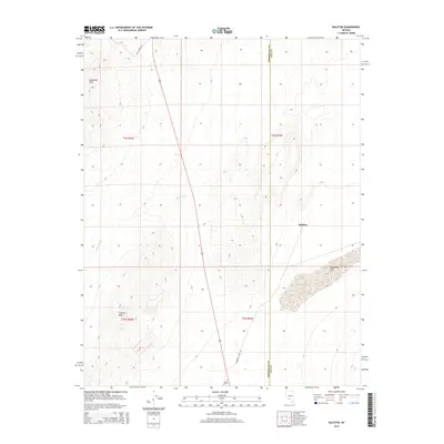
2014 Map of Ralston
USGS Topo · Published 2014About this map
Goldfield Hills and the Cuprite Hills define the high desert topography of this region, which straddles the border between Esmeralda and Nye counties. This 2014 survey captures a landscape shaped by drainage patterns like China Wash, which cuts through the arid basins common to this part of the Great Basin. The small settlement of Ralston serves as a lone outpost near the intersection of various desert routes, including Mt Jackson Rd and Stonewall Flats Rd. The map also details the transition from the upland hills into the broad expanse of Stonewall Flat to the southeast, illustrating how transport corridors are dictated by the natural breaks in the desert terrain.
Find a feature on this map
12 named features on this map. Tap any name to fly to it.
Don’t see what you’re looking for? This feature index may not catch every label — zoom into the map to look around manually.
Map Details
Editions of this 2014 Ralston Map
This is the sole edition of this map. No revisions or reprints were ever made.
Other maps of this area

1908 · Lida
USGS Topo · 1:250,000

1913 · Lida
USGS Topo · 1:250,000

1945 · Goldfield
USGS Topo · 1:125,000

1952 · Goldfield
USGS Topo · 1:62,500

1954 · Goldfield
USGS Topo · 1:250,000

1955 · Goldfield
USGS Topo · 1:250,000

1958 · Goldfield
USGS Topo · 1:250,000

1962 · Goldfield
USGS Topo · 1:250,000

1968 · Stonewall Pass
USGS Topo · 1:24,000
1968 · Scottys Junction NE
USGS Topo · 1:24,000