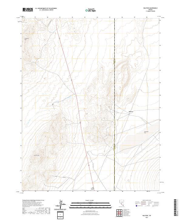
2021 Map of Ralston
USGS Topo · Published 2021About this map
Goldfield Hills and the Cuprite Hills dominate this high desert landscape along the border of Esmeralda and Nye Counties. The map reveals a sparse infrastructure centered around the settlement of Ralston, where the intersection of US Route 95 and local paths such as E Railroad Springs Rd form the primary transit corridor. To the south, the Lida Junction Airport serves as a remote aviation landmark near the transition to the expansive Stonewall Flat. The ephemeral nature of the water supply is evidenced by the prominent China Wash, which cuts across the arid basin floor, reflecting the harsh environmental conditions that have shaped local settlement and transportation patterns in this portion of the Nevada desert.
Find a feature on this map
13 named features on this map. Tap any name to fly to it.
Don’t see what you’re looking for? This feature index may not catch every label — zoom into the map to look around manually.
Map Details
Editions of this 2021 Ralston Map
This is the sole edition of this map. No revisions or reprints were ever made.
Other maps of this area

1908 · Lida
USGS Topo · 1:250,000

1913 · Lida
USGS Topo · 1:250,000

1945 · Goldfield
USGS Topo · 1:125,000

1952 · Goldfield
USGS Topo · 1:62,500

1954 · Goldfield
USGS Topo · 1:250,000

1955 · Goldfield
USGS Topo · 1:250,000

1958 · Goldfield
USGS Topo · 1:250,000

1962 · Goldfield
USGS Topo · 1:250,000

1968 · Stonewall Pass
USGS Topo · 1:24,000
1968 · Scottys Junction NE
USGS Topo · 1:24,000