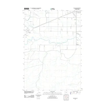
2012 Map of Ralston
USGS Topo · Published 2012About this map
The Shoshone River carves through this Park County landscape, defining the transition between the irrigated agricultural valley and the surrounding high desert. The small settlement of Ralston serves as a local hub, situated at the intersection of early 20th-century irrigation efforts and modern transport routes. A sophisticated network of water management is visible, including the Garland Canal, Frannie Canal, and numerous engineered waterways like Lateral S and Lateral R, which turned this arid region into productive farmland. To the east, the community of Willwood sits near the river's edge, surrounded by a grid of rural roads and lanes named for early local families and land divisions. The terrain is further marked by natural drainages such as Bitter Creek, Alkali Creek, and Deer Creek, illustrating the complex hydrology of the Big Horn Basin. This survey provides a precise view of the rural infrastructure, from the small siding at O'Donnell to the residential streets of Carbon Street.
Find a feature on this map
49 named features on this map. Tap any name to fly to it.
Don’t see what you’re looking for? This feature index may not catch every label — zoom into the map to look around manually.
Map Details
Editions of this 2012 Ralston Map
This is the sole edition of this map. No revisions or reprints were ever made.
Other maps of this area

1955 · Cody
USGS Topo · 1:250,000

1958 · Cody
USGS Topo · 1:250,000

1962 · Cody
USGS Topo · 1:250,000

1966 · Elk Basin SW
USGS Topo · 1:24,000

1966 · Stone Barn Camp
USGS Topo · 1:24,000

1966 · Garland
USGS Topo · 1:24,000

1966 · Elk Basin SE
USGS Topo · 1:24,000

1966 · Gilmore Hill NW
USGS Topo · 1:24,000

1966 · Corbett Dam
USGS Topo · 1:24,000

1966 · Gilmore Hill
USGS Topo · 1:24,000