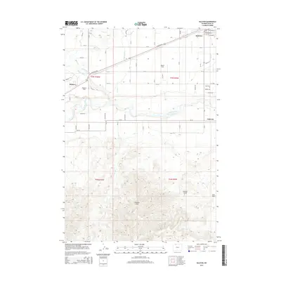
2015 Map of Ralston
USGS Topo · Published 2015About this map
Powell anchor the northeast corner of this Park County survey, where the desert landscape of the Bighorn Basin is transformed by an intricate network of irrigation. The Garland Canal and Frannie Canal weave through the terrain, supporting the agricultural vitality of the Powell Flats and Ralston Flats. This dependency on managed water is a defining characteristic of the region, visible in the numerous laterals such as Lateral R and Lateral T that branch off to serve individual farm plots near the settlement of Ralston.
Find a feature on this map
62 named features on this map. Tap any name to fly to it.
Don’t see what you’re looking for? This feature index may not catch every label — zoom into the map to look around manually.
Map Details
Editions of this 2015 Ralston Map
This is the sole edition of this map. No revisions or reprints were ever made.
Other maps of this area

1955 · Cody
USGS Topo · 1:250,000

1958 · Cody
USGS Topo · 1:250,000

1962 · Cody
USGS Topo · 1:250,000

1966 · Elk Basin SW
USGS Topo · 1:24,000

1966 · Stone Barn Camp
USGS Topo · 1:24,000

1966 · Garland
USGS Topo · 1:24,000

1966 · Elk Basin SE
USGS Topo · 1:24,000

1966 · Gilmore Hill NW
USGS Topo · 1:24,000

1966 · Corbett Dam
USGS Topo · 1:24,000

1966 · Gilmore Hill
USGS Topo · 1:24,000