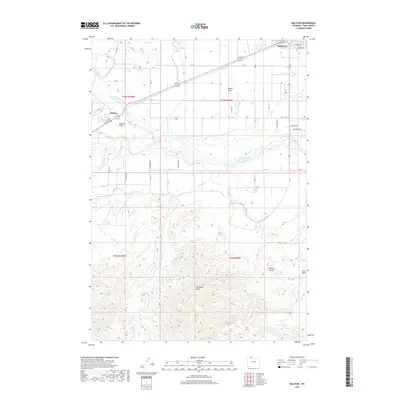
2017 Map of Ralston
USGS Topo · Published 2017About this map
The Shoshone River valley defines the central landscape of this Park County region, where the high desert terrain is transformed by an extensive irrigation network. The Garland Canal and Frannie Canal dominate the northern half of the map, supporting the agricultural communities of Ralston and the southern edge of Powell. This complex system of laterals, including Lateral R and Lateral S, feeds the cultivated fields of Powell Flats and Ralston Flats, creating a sharp contrast with the arid, dissected topography to the south. In this southern portion, the land rises into a series of drainages and seasonal watercourses such as Willwood Draw, Peerless Coulee, and Roan Wash. The transition from the structured grid of the irrigated valley to the natural contours of the Big Horn Basin provides a clear look at the intersection of water engineering and local settlement patterns.
Find a feature on this map
56 named features on this map. Tap any name to fly to it.
Don’t see what you’re looking for? This feature index may not catch every label — zoom into the map to look around manually.
Map Details
Editions of this 2017 Ralston Map
This is the sole edition of this map. No revisions or reprints were ever made.
Other maps of this area

1955 · Cody
USGS Topo · 1:250,000

1958 · Cody
USGS Topo · 1:250,000

1962 · Cody
USGS Topo · 1:250,000

1966 · Elk Basin SW
USGS Topo · 1:24,000

1966 · Stone Barn Camp
USGS Topo · 1:24,000

1966 · Garland
USGS Topo · 1:24,000

1966 · Elk Basin SE
USGS Topo · 1:24,000

1966 · Gilmore Hill NW
USGS Topo · 1:24,000

1966 · Corbett Dam
USGS Topo · 1:24,000

1966 · Gilmore Hill
USGS Topo · 1:24,000