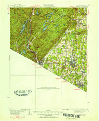
1931 Map of Ramapo
USGS Topo · Published 1956About this map
The Ramapo River valley and the highlands of the Palisades Interstate Park define this detailed survey, conducted across the late 1920s and early 1930s. The landscape is a transition between the rocky ridges of Tiger Mtn and Jackie Jones Mtn and the developing residential and institutional corridors of eastern Rockland County. A significant concentration of early 20th-century social infrastructure is visible, including the sprawling grounds of Letchworth Village and various charitable facilities like the Kingsland Home and St Agatha Home.
Find a feature on this map
159 named features on this map. Tap any name to fly to it.
Don’t see what you’re looking for? This feature index may not catch every label — zoom into the map to look around manually.
Map Details
Editions of this 1931 Ramapo Map
3 editions found
Other maps of this area

1888 · Morristown
USGS Topo · 1:62,500

1888 · Paterson
USGS Topo · 1:62,500

1891 · Greenwood Lake
USGS Topo · 1:62,500

1891 · Ramapo
USGS Topo · 1:62,500

1891 · Harlem
USGS Topo · 1:62,500

1892 · West Point
USGS Topo · 1:62,500

1892 · Paterson
USGS Topo · 1:62,500

1892 · Tarrytown
USGS Topo · 1:62,500

1893 · Greenwood Lake
USGS Topo · 1:62,500

1893 · Tarrytown
USGS Topo · 1:62,500