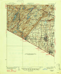
1938 Map of Ramapo
USGS Topo · Published 1947About this map
The Erie Railroad carves through the narrow valley of the Mahwah River, connecting industrial settlements like Sloatsburg, Ramapo, and Suffern against the backdrop of the Ramapo Mountains. This pre-war landscape is defined by its institutional and industrial footprint, featuring the sprawling grounds of the Letchworth Village State Institute for Feeble Minded and social landmarks such as the Kings Land Home and St Agatha Home. To the west, the rugged terrain of Harriman State Park preserves the region's mining heritage, including the Sterling Mine and Hogencamp Mine near numerous glacial water bodies like Tuxedo Lake and Sebago Lake. The map details a transition from the dense mountain forests and iron-rich peaks to the developing suburbs of Spring Valley and Pearl River, where local education and faith are centered at places like Harriman Farm Sch and Wesley Chapel.
Find a feature on this map
132 named features on this map. Tap any name to fly to it.
Don’t see what you’re looking for? This feature index may not catch every label — zoom into the map to look around manually.
Map Details
Editions of this 1938 Ramapo Map
3 editions found
Other maps of this area

1888 · Morristown
USGS Topo · 1:62,500

1888 · Paterson
USGS Topo · 1:62,500

1891 · Greenwood Lake
USGS Topo · 1:62,500

1891 · Ramapo
USGS Topo · 1:62,500

1891 · Harlem
USGS Topo · 1:62,500

1892 · West Point
USGS Topo · 1:62,500

1892 · Paterson
USGS Topo · 1:62,500

1892 · Tarrytown
USGS Topo · 1:62,500

1893 · Greenwood Lake
USGS Topo · 1:62,500

1893 · Tarrytown
USGS Topo · 1:62,500