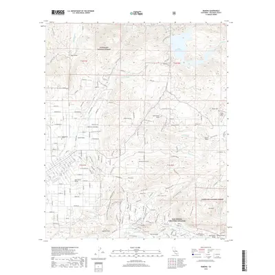
2018 Map of Ramona
USGS Topo · Published 2018About this map
San Diego Country Estates occupies the lower center of this survey, showing the residential footprint of this planned community south of the Santa Maria Valley. To the north, the terrain rises into the Cleveland National Forest, where the Lake Sutherland reservoir is held by a dam along the Santa Ysabel Creek. The landscape is a series of distinct valleys, including Pamo Valley, Goose Valley, and Ballena Valley, each separated by significant peaks such as Whale Mountain and Mount Gower. Local history and aviation are noted through the presence of the Flying T Ranch Airport and several burial grounds, including Ballena Cemetery and Nuevo Memory Gardens. The network of backroads like Black Canyon Road and Sutherland Dam Road provides a view into how the rural spaces between these valleys were accessed in the late 2010s.
Find a feature on this map
147 named features on this map. Tap any name to fly to it.
Don’t see what you’re looking for? This feature index may not catch every label — zoom into the map to look around manually.
Map Details
Editions of this 2018 Ramona Map
This is the sole edition of this map. No revisions or reprints were ever made.
Other maps of this area

1893 · El Cajon
USGS Topo · 1:62,500

1901 · Elcajon
USGS Topo · 1:62,500

1903 · Cuyamaca
USGS Topo · 1:125,000

1903 · Elcajon
USGS Topo · 1:62,500

1903 · Ramona
USGS Topo · 1:125,000

1904 · Southern California Sheet No. 2
USGS Topo · 1:250,000

1939 · El Cajon
USGS Topo · 1:62,500

1939 · Santa Ysabel
USGS Topo · 1:62,500

1942 · El Cajon
USGS Topo · 1:62,500

1942 · Ramona
USGS Topo · 1:62,500