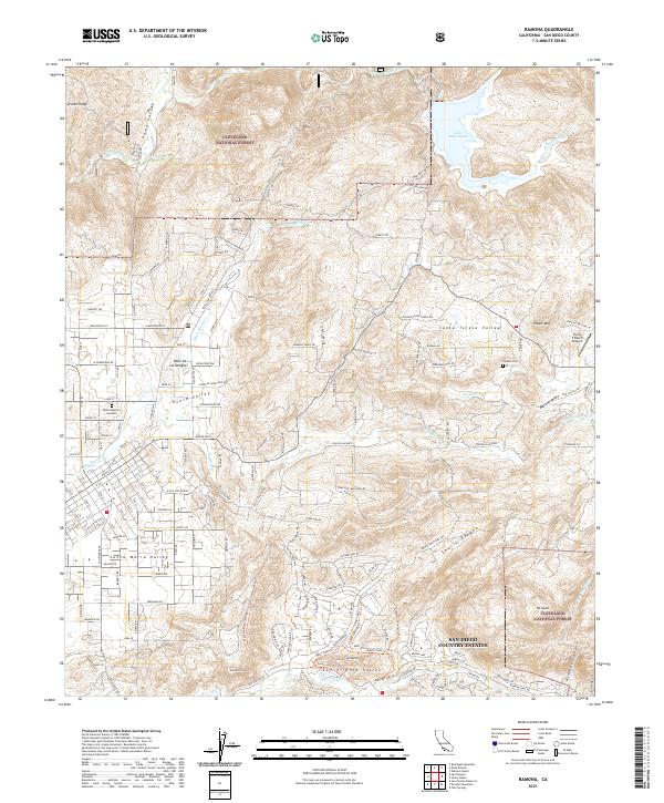
2021 Map of Ramona
USGS Topo · Published 2021About this map
San Diego Country Estates and the developing residential stretches of the Santa Maria Valley anchor this recent look at the Ramona area. The landscape transitions from the planned community footprints in the south toward the protected wilderness of the Cleveland National Forest. Significant water features like Lake Sutherland and the winding Santa Ysabel Cr define the northern drainages, while the central portion is marked by the agricultural and equestrian character of Goose Valley and Santa Teresa Valley.
Find a feature on this map
175 named features on this map. Tap any name to fly to it.
Don’t see what you’re looking for? This feature index may not catch every label — zoom into the map to look around manually.
Map Details
Editions of this 2021 Ramona Map
This is the sole edition of this map. No revisions or reprints were ever made.
Other maps of this area

1893 · El Cajon
USGS Topo · 1:62,500

1901 · Elcajon
USGS Topo · 1:62,500

1903 · Cuyamaca
USGS Topo · 1:125,000

1903 · Elcajon
USGS Topo · 1:62,500

1903 · Ramona
USGS Topo · 1:125,000

1904 · Southern California Sheet No. 2
USGS Topo · 1:250,000

1939 · El Cajon
USGS Topo · 1:62,500

1939 · Santa Ysabel
USGS Topo · 1:62,500

1942 · El Cajon
USGS Topo · 1:62,500

1942 · Ramona
USGS Topo · 1:62,500