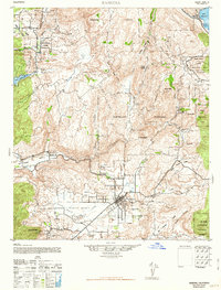
1942 Map of Ramona
USGS Topo · Published 1963About this map
Santa Maria Valley and the settlement of Ramona serve as the hub of this mid-century survey, which details a landscape transitioning from ranching outposts to established rural communities. The map documents numerous tribal lands, including the Rincon Indian Reservation and the Santa Ysabel Indian Reservation No. 1, alongside family-named holdings like Vineyard Ranch and Almond Ranch.
Find a feature on this map
50 named features on this map. Tap any name to fly to it.
Don’t see what you’re looking for? This feature index may not catch every label — zoom into the map to look around manually.
Map Details
Editions of this 1942 Ramona Map
2 editions found

Other maps of this area

1893 · El Cajon
USGS Topo · 1:62,500

1893 · Escondido
USGS Topo · 1:62,500

1901 · Elcajon
USGS Topo · 1:62,500

1901 · Escondido
USGS Topo · 1:62,500

1901 · San Luis Rey
USGS Topo · 1:125,000

1903 · Cuyamaca
USGS Topo · 1:125,000

1903 · La Jolla
USGS Topo · 1:62,500

1903 · Elcajon
USGS Topo · 1:62,500

1903 · Ramona
USGS Topo · 1:125,000

1904 · Southern California Sheet No. 2
USGS Topo · 1:250,000