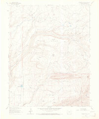
1963 Map of Rampart Hills
USGS Topo · Published 1973About this map
High-altitude water management and early timber operations define this portion of the San Juan National Forest in the early 1960s. The landscape is marked by a sophisticated network of small reservoirs and irrigation ditches, such as the Weber Reservoir and Menefee Reservoir, which capture runoff from the Rampart Hills to feed the valley below. The area's industrial history is anchored by the Spruce Mill, located near Spruce Mill Park, and the Gold Dollar Mine situated along the drainage of Gold Run.
Find a feature on this map
53 named features on this map. Tap any name to fly to it.
Don’t see what you’re looking for? This feature index may not catch every label — zoom into the map to look around manually.
Map Details
Editions of this 1963 Rampart Hills Map
3 editions found
Other maps of this area

1895 · La Plata
USGS Topo · 1:62,500

1897 · La Plata
USGS Topo · 1:62,500

1897 · Rico
USGS Topo · 1:62,500

1898 · Rico
USGS Topo · 1:62,500

1899 · La Plata
USGS Topo · 1:62,500

1899 · Rico
USGS Topo · 1:62,500

1908 · La Plata
USGS Topo · 1:62,500

1956 · Cortez
USGS Topo · 1:250,000

1958 · Cortez
USGS Topo · 1:250,000

1959 · Cortez
USGS Topo · 1:250,000