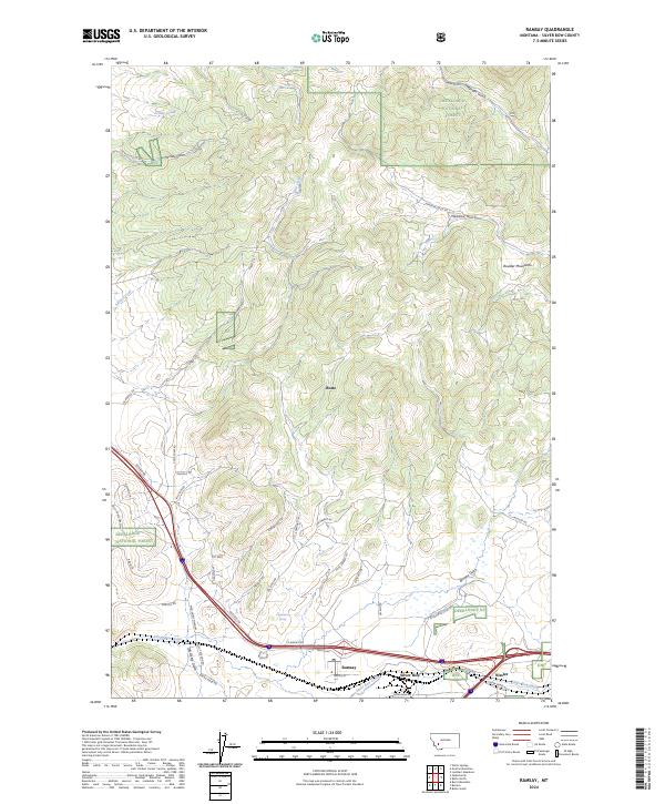
2024 Map of Ramsay
USGS Topo · Published 2024About this map
Ramsay and the adjacent settlements of Nissler and Silver Bow anchor the southern corridor of this landscape, situated where the terrain transitions toward the Boulder Mountains. The area is defined by a dense network of gulches and drainages, including Telegraph Gulch, Meadow Gulch, and Hensley Gulch, which cut through the northern reaches of the Deerlodge National Forest.
Find a feature on this map
51 named features on this map. Tap any name to fly to it.
Don’t see what you’re looking for? This feature index may not catch every label — zoom into the map to look around manually.
Map Details
Editions of this 2024 Ramsay Map
This is the sole edition of this map. No revisions or reprints were ever made.
Other maps of this area

1889 · Helena
USGS Topo · 1:250,000

1893 · Helena
USGS Topo · 1:250,000

1893 · Dillon
USGS Topo · 1:250,000

1899 · Helena
USGS Topo · 1:250,000

1903 · Helena
USGS Topo · 1:250,000

1947 · Butte
USGS Topo · 1:250,000

1955 · Dillon
USGS Topo · 1:250,000

1957 · Dillon
USGS Topo · 1:250,000

1958 · Butte
USGS Topo · 1:250,000

1958 · Dillon
USGS Topo · 1:250,000