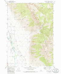
1969 Map of Ramshorn Canyon
USGS Topo · Published 1986About this map
The Big Lost River valley defines this high-elevation landscape on the border of Butte and Custer counties. During the late 1960s, the area's agricultural reliance on the river is evident through a complex network of water management features, including the Moore Diversion, a Gaging Station, and numerous irrigation channels like the Beck and Evan Ditch Road. These systems supported the flatlands between the towering peaks of the Lost River Range and the Challis National Forest.
Find a feature on this map
36 named features on this map. Tap any name to fly to it.
Don’t see what you’re looking for? This feature index may not catch every label — zoom into the map to look around manually.
Map Details
Editions of this 1969 Ramshorn Canyon Map
2 editions found
Other maps of this area

1955 · Idaho Falls
USGS Topo · 1:250,000

1958 · Idaho Falls
USGS Topo · 1:250,000

1969 · Darlington
USGS Topo · 1:24,000

1969 · Arco Pass
USGS Topo · 1:24,000

1969 · Ramshorn Canyon
USGS Topo · 1:24,000

1969 · Howe NW
USGS Topo · 1:24,000

1969 · Sunset Peak
USGS Topo · 1:24,000
1969 · Methodist Creek
USGS Topo · 1:24,000

1972 · Arco North
USGS Topo · 1:24,000

1972 · Arco Hills
USGS Topo · 1:24,000