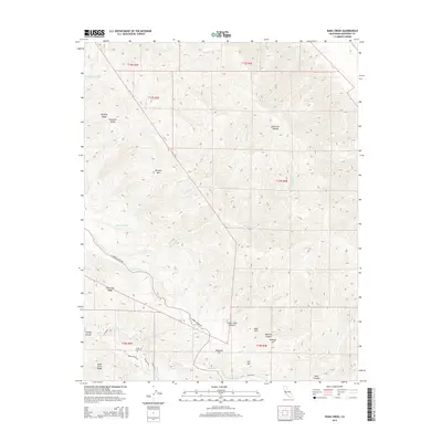
2015 Map of Rana Creek
USGS Topo · Published 2015About this map
The Sierra de Salinas and the Santa Lucia Range dominate this Monterey County interior, where steep canyons and high ridges define the drainages of the Carmel Valley watershed. The network of ephemeral and perennial streams, including Rana Cr, Agua Mala Cr, and Tularcitos Cr, carved the complex topography that historically limited development to the valley floors. E Carmel Valley Rd serves as the primary corridor through this landscape, connecting the coastal regions to the inland ranching and agricultural lands. Distinctive high points such as Burned Mtn, Haystack Hill, and Buckeye Hill provide prominent landmarks for surveying and navigation. Small roads like Parrot Ranch Rd and Martin Rd branch into side canyons like Corral Viejo Canyon and Madrona Canyon, tracing the paths of early land use and settlement in this section of the coastal range.
Find a feature on this map
34 named features on this map. Tap any name to fly to it.
Don’t see what you’re looking for? This feature index may not catch every label — zoom into the map to look around manually.
Map Details
Editions of this 2015 Rana Creek Map
This is the sole edition of this map. No revisions or reprints were ever made.
Other maps of this area

1910 · Gonzales
USGS Topo · 1:31,680

1910 · Salinas
USGS Topo · 1:31,680

1910 · Soledad
USGS Topo · 1:31,680

1912 · Salinas
USGS Topo · 1:62,500

1915 · Soledad
USGS Topo · 1:62,500

1920 · Jamesburg
USGS Topo · 1:48,000

1921 · Jamesburg
USGS Topo · 1:62,500

1921 · Gonzales
USGS Topo · 1:62,500

1939 · Jamesburg
USGS Topo · 1:62,500

1940 · Salinas
USGS Topo · 1:62,500