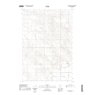
2020 Map of Rancher Cemetery
USGS Topo · Published 2020About this map
Pease Bottom serves as the focal point of this rural landscape in Treasure County, where the topography transition from the flatlands of the Yellowstone River valley into a network of drainages and coulees. The namesake Rancher Cem is positioned near the junction of Myers Rd and Fort Pease Rd, providing a specific anchor for family historians and genealogists researching early settlement patterns in this part of Montana. Irrigation infrastructure is evidenced by the presence of Rancher Ditch, which supports the agricultural viability of the lowlands. Further north, the terrain becomes increasingly complex, carved by seasonal watercourses such as Muggins Cr, Alkali Cr, and N Fork Edwards Cr. A network of unpaved routes, including Sumatra Rd and Cat Coulee Ln, provides access to the higher ground of the northern townships.
Find a feature on this map
16 named features on this map. Tap any name to fly to it.
Don’t see what you’re looking for? This feature index may not catch every label — zoom into the map to look around manually.
Map Details
Editions of this 2020 Rancher Cemetery Map
This is the sole edition of this map. No revisions or reprints were ever made.
Other maps of this area

1954 · Forsyth
USGS Topo · 1:250,000

1957 · Forsyth
USGS Topo · 1:250,000

1958 · Forsyth
USGS Topo · 1:250,000

1960 · Bighorn
USGS Topo · 1:24,000

1960 · Steie Ranch
USGS Topo · 1:24,000

1960 · Custer
USGS Topo · 1:24,000

1960 · Myers
USGS Topo · 1:24,000

1960 · Rancher Cemetery
USGS Topo · 1:24,000

1960 · Eldering Ranch
USGS Topo · 1:24,000

1960 · Mc Konkey Creek
USGS Topo · 1:24,000