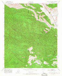
1943 Map of Rancho Nuevo Creek
USGS Topo · Published 1967About this map
Los Padres National Forest dominates this 1940s landscape, where the high backcountry of the Santa Barbara and Ventura County line meets the rugged drainages of the Cuyama River. The topography is defined by significant landmarks such as Lizard Head and Morro Hill, with the deep incisions of Rancho Nuevo Creek and Bear Canyon carving through the terrain. Human presence is sparse and focused on utility and education, evidenced by the Apache Sch and a remote Ranger Sta. The inclusion of a Windmill and the high meadow at Potrero Seco suggests the seasonal livestock and forestry activities that historically sustained this remote corner of the California mountains. Water sources like Tinta Creek and Lacosea Creek are critical features in this arid, high-elevation environment before modern development reached the interior canyons.
Find a feature on this map
16 named features on this map. Tap any name to fly to it.
Don’t see what you’re looking for? This feature index may not catch every label — zoom into the map to look around manually.
Map Details
Editions of this 1943 Rancho Nuevo Creek Map
3 editions found
Other maps of this area

1902 · Santa Ynez
USGS Topo · 1:125,000

1903 · Mt. Pinos
USGS Topo · 1:125,000

1905 · Santa Ynez
USGS Topo · 1:125,000

1942 · Wheeler Springs
USGS Topo · 1:24,000

1943 · Rancho Nuevo Creek
USGS Topo · 1:24,000

1943 · Old Man Mountain
USGS Topo · 1:24,000

1943 · Apache Canyon
USGS Topo · 1:24,000

1943 · Cuyama Peak
USGS Topo · 1:24,000

1943 · Reyes Peak
USGS Topo · 1:24,000

1943 · Wheeler Springs
USGS Topo · 1:24,000