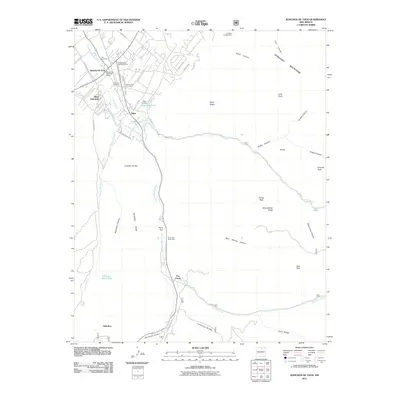
2011 Map of Ranchos De Taos
USGS Topo · Published 2011About this map
Ranchos de Taos serves as the focal point of this northern New Mexico landscape, where the high desert meets the rising slopes of the Fernando Mountains. The settlement pattern reflects deep-rooted community history, visible in the cluster of burial grounds such as Hart Cemetery, Camposanto Jesus Nazareno, and Saint Francis Cemetery. Water management is central to the area's survival, evidenced by the Acequia Madre del Rio Chiquito and Acequia de Abajo la Loma—traditional irrigation ditches that divert the flow of the Rio Grande del Rancho to support the villages of Llano Quemado and Talpa. Further south, the terrain becomes more isolated as it ascends into the national forest, marked by features like Cuchilla Del Ojo and Pinoreal Peak, with forest roads leading to the quiet outposts of Pot Creek and Vallecitos.
Find a feature on this map
56 named features on this map. Tap any name to fly to it.
Don’t see what you’re looking for? This feature index may not catch every label — zoom into the map to look around manually.
Map Details
Editions of this 2011 Ranchos De Taos Map
This is the sole edition of this map. No revisions or reprints were ever made.
Other maps of this area

1954 · Raton
USGS Topo · 1:250,000

1958 · Raton
USGS Topo · 1:250,000

1964 · Los Cordovas
USGS Topo · 1:24,000

1964 · Taos
USGS Topo · 1:24,000

1964 · Tres Ritos
USGS Topo · 1:24,000

1964 · Ranchos De Taos
USGS Topo · 1:24,000

1964 · Penasco
USGS Topo · 1:24,000

1964 · Taos SW
USGS Topo · 1:24,000

1965 · Pueblo Peak
USGS Topo · 1:24,000

1965 · Shady Brook
USGS Topo · 1:24,000