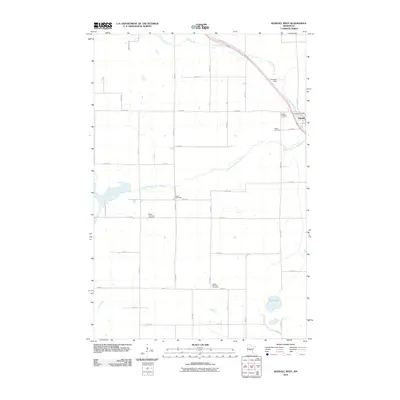
2010 Map of Randall West
USGS Topo · Published 2010About this map
Randall sits at the northeastern corner of this landscape, where the Little Elk River flows through the township. The surrounding terrain is defined by a dense grid of rural roads and the winding paths of the South Branch Little Elk River and Ten Brook Creek. This 2010 survey highlights a deeply rooted agricultural community, evidenced by several distinct burial grounds including Parker Cemetery, Randall Cemetery, and the Parker-Bethany Cemetery. Local governance and infrastructure are centered at the Parker Town Hall and the Randall Post Office, while the inclusion of Chandler Field suggests the continued importance of small-scale aviation in the region. The map captures the interface between the township's waterways and the systematic section lines of the Minnesota countryside.
Find a feature on this map
40 named features on this map. Tap any name to fly to it.
Don’t see what you’re looking for? This feature index may not catch every label — zoom into the map to look around manually.
Map Details
Editions of this 2010 Randall West Map
This is the sole edition of this map. No revisions or reprints were ever made.
Other maps of this area

1947 · Flensburg
USGS Topo · 1:25,000

1948 · Belle Prairie
USGS Topo · 1:62,500

1948 · Cushing
USGS Topo · 1:62,500

1948 · Little Falls
USGS Topo · 1:62,500

1950 · Swanville
USGS Topo · 1:62,500

1950 · Belle Prairie
USGS Topo · 1:62,500

1950 · Little Falls
USGS Topo · 1:62,500

1950 · Cushing
USGS Topo · 1:62,500

1951 · Flensburg
USGS Topo · 1:25,000

1953 · Brainerd
USGS Topo · 1:250,000