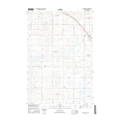
2016 Map of Randall West
USGS Topo · Published 2016About this map
The Little Elk River winds through this section of Morrison County, defining a landscape of low-lying wetlands and agricultural tracts just west of the Randall settlement. This 2016 survey highlights a community anchored by its local history, with several burial grounds scattered across the township, including the Randall Cem and Parker Cem. The drainage patterns of the area are complex, with the S Br Little Elk River and tributaries like Hay Cr and Irish Cr feeding into larger basins such as Mud Lake. The map reveals a strictly gridded rural road network, featuring routes like Co HWY 1 and Co RD 217, which provide access to remote farmsteads and the Parker Township Cem. This document serves as a detailed record of land use and water management in central Minnesota at the start of the twenty-first century.
Find a feature on this map
36 named features on this map. Tap any name to fly to it.
Don’t see what you’re looking for? This feature index may not catch every label — zoom into the map to look around manually.
Map Details
Editions of this 2016 Randall West Map
This is the sole edition of this map. No revisions or reprints were ever made.
Other maps of this area

1947 · Flensburg
USGS Topo · 1:25,000

1948 · Belle Prairie
USGS Topo · 1:62,500

1948 · Cushing
USGS Topo · 1:62,500

1948 · Little Falls
USGS Topo · 1:62,500

1950 · Swanville
USGS Topo · 1:62,500

1950 · Belle Prairie
USGS Topo · 1:62,500

1950 · Little Falls
USGS Topo · 1:62,500

1950 · Cushing
USGS Topo · 1:62,500

1951 · Flensburg
USGS Topo · 1:25,000

1953 · Brainerd
USGS Topo · 1:250,000