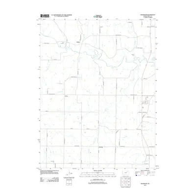
2012 Map of Randolph
USGS Topo · Published 2012About this map
Winkler and Walsburg serve as the primary focal points of this rural landscape in Riley County, where the terrain is defined by the winding paths of Fancy Cr and its numerous tributaries. The map reveals a high concentration of burial grounds, including Saint Johns Cem and Crooked Creek Cem, which often point to the locations of earlier community centers. A notable geographic feature in the east is the reach of Tuttle Creek Lake, which has significantly altered the local hydrology compared to nineteenth-century surveys.
Find a feature on this map
53 named features on this map. Tap any name to fly to it.
Don’t see what you’re looking for? This feature index may not catch every label — zoom into the map to look around manually.
Map Details
Editions of this 2012 Randolph Map
This is the sole edition of this map. No revisions or reprints were ever made.
Other maps of this area

1886 · Junction City
USGS Topo · 1:125,000

1889 · Marysville
USGS Topo · 1:125,000

1889 · Junction City
USGS Topo · 1:125,000

1894 · Junction City
USGS Topo · 1:125,000

1894 · Marysville
USGS Topo · 1:125,000

1955 · Manhattan
USGS Topo · 1:250,000

1956 · Manhattan
USGS Topo · 1:250,000

1957 · Manhattan
USGS Topo · 1:250,000
1963 · Bala
USGS Topo · 1:24,000
1963 · Lasita
USGS Topo · 1:24,000