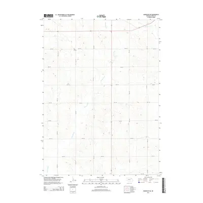
2014 Map of Randolph SW
USGS Topo · Published 2014About this map
Rose Hill Cem stands as a primary landmark in this rural landscape of northern Pierce County, situated just off 864th Rd. The area is defined by its precise agrarian grid and the slow drainage patterns of Yankton Slough, which meanders across the territory. In the northeast, Middle Logan Cr cuts through the rolling terrain, providing a natural break in the otherwise uniform section lines. This 2014 survey by the U.S. Geological Survey illustrates the modern configuration of the Nebraska plains, where well-maintained gravel routes such as 554th Ave and 860th Rd facilitate the movement of local agricultural trade. The map serves as a detailed record of land use and drainage in a region where water management and cemetery preservation are key markers of local heritage.
Find a feature on this map
16 named features on this map. Tap any name to fly to it.
Don’t see what you’re looking for? This feature index may not catch every label — zoom into the map to look around manually.
Map Details
Editions of this 2014 Randolph SW Map
This is the sole edition of this map. No revisions or reprints were ever made.
Other maps of this area

1955 · Sioux City
USGS Topo · 1:250,000

1958 · Sioux City
USGS Topo · 1:250,000

1959 · Sioux City
USGS Topo · 1:250,000

1963 · Osmond
USGS Topo · 1:24,000

1963 · Wee Town
USGS Topo · 1:24,000
1963 · Pierce
USGS Topo · 1:24,000

1963 · Norfolk NE
USGS Topo · 1:24,000

1971 · Wausa
USGS Topo · 1:24,000

1971 · Randolph South
USGS Topo · 1:24,000

1971 · Randolph North
USGS Topo · 1:24,000