
1911 Map of Randsburg
USGS Topo · Published 1958About this map
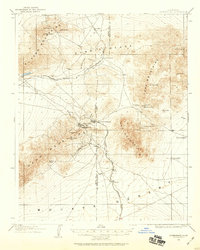
Gold and tungsten mining define the industrial landscape of the Mojave high desert in the early twentieth century. The Yellow Aster Mine dominates the northern slopes above Randsburg, a hub of activity where several roads and trails converge. This survey shows the early rail infrastructure critical to the region's extraction economy, including the Southern Pacific line through Rand and the Randsburg Branch of the Atchison Topeka and Santa Fe, which connects the communities of Johannesburg, Atolia, and St Elmo.
Find a feature on this map
38 named features on this map. Tap any name to fly to it.
Don’t see what you’re looking for? This feature index may not catch every label — zoom into the map to look around manually.
Map Details
Editions of this 1911 Randsburg Map
2 editions found
Other maps of this area

1903 · Randsburg
USGS Topo · 1:62,500

1912 · Randsburg
USGS Topo · 1:62,500

1915 · Searles Lake
USGS Topo · 1:250,000

1943 · Inyokern
USGS Topo · 1:62,500

1943 · Saltdale
USGS Topo · 1:62,500

1943 · Castle Butte
USGS Topo · 1:62,500

1947 · Castle Butte
USGS Topo · 1:50,000

1947 · Trona
USGS Topo · 1:250,000

1948 · Trona
USGS Topo · 1:250,000

1949 · Searles Lake
USGS Topo · 1:62,500