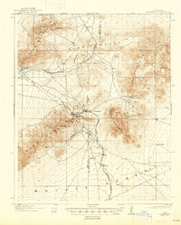
1912 Map of Randsburg
USGS Topo · Published 1947About this map
Mining and desert transportation define this high-desert region during a period of intense mineral extraction. At the heart of the district lies Randsburg, a hub of activity anchored by the massive Yellow Aster Mine on the slopes above the town. The neighboring settlement of Johannesburg serves as the terminus for the Atchison Topeka and Santa Fe (Randsburg Branch), which winds south past Atolia and St Elmo. The landscape is characterized by a series of rugged uplands including the Rand Mountains, Summit Range, and the Lava Mountains. To the north, the Southern Pacific tracks cross the valley near Searles, while the southern reaches of the map dissolve into the open Mojave Desert. This survey captures the critical water infrastructure necessary for desert survival, from Willow Spring to the mineral-heavy Blackhawk Well.
Find a feature on this map
34 named features on this map. Tap any name to fly to it.
Don’t see what you’re looking for? This feature index may not catch every label — zoom into the map to look around manually.
Map Details
Editions of this 1912 Randsburg Map
3 editions found
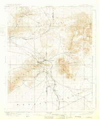
Other maps of this area

1903 · Randsburg
USGS Topo · 1:62,500

1911 · Randsburg
USGS Topo · 1:62,500

1912 · Randsburg
USGS Topo · 1:62,500

1915 · Searles Lake
USGS Topo · 1:250,000

1943 · Inyokern
USGS Topo · 1:62,500

1943 · Saltdale
USGS Topo · 1:62,500

1943 · Castle Butte
USGS Topo · 1:62,500

1947 · Castle Butte
USGS Topo · 1:50,000

1947 · Trona
USGS Topo · 1:250,000

1948 · Trona
USGS Topo · 1:250,000