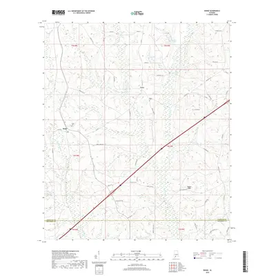
2018 Map of Range
USGS Topo · Published 2018About this map
Lenox and Range occupy a rural landscape in southern Alabama where the headwaters of Little Escambia Cr and Brushy Cr carve through the terrain. This 2018 survey illustrates a region defined by its creek-bound boundaries and a network of named country roads that speak to long-standing family settlements. The community of Janes Mill sits near the confluence of local tributaries, while the presence of Ramah Cem and Range Cem provides essential touchpoints for genealogical research in this part of Conecuh County. Interstate 65 cuts a modern diagonal across the traditional geography, juxtaposing high-speed transit against the winding paths of Burnt Corn Cr and smaller waters like Rattlesnake Cr. The map captures the meeting of Conecuh and Escambia counties, preserving the layout of timberlands and small clearings that have sustained these communities for generations.
Find a feature on this map
46 named features on this map. Tap any name to fly to it.
Don’t see what you’re looking for? This feature index may not catch every label — zoom into the map to look around manually.
Map Details
Editions of this 2018 Range Map
This is the sole edition of this map. No revisions or reprints were ever made.
Other maps of this area

1953 · Andalusia
USGS Topo · 1:250,000

1957 · Andalusia
USGS Topo · 1:250,000

1960 · Brewton North
USGS Topo · 1:24,000

1960 · Barnett Crossroads
USGS Topo · 1:24,000

1960 · Wallace
USGS Topo · 1:24,000

1971 · Range
USGS Topo · 1:24,000

1971 · Castleberry
USGS Topo · 1:24,000

1971 · Belleville
USGS Topo · 1:24,000

1971 · Repton
USGS Topo · 1:24,000

1972 · Frisco City SE
USGS Topo · 1:24,000