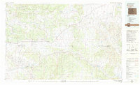
1979 Map of Rangely
USGS Topo · Published 1979About this map
The Rangely Oil Field dominates the southern landscape of this 1979 survey, indicating the significant petroleum economy of Rio Blanco County during the late 1970s. The town of Rangely serves as a central hub, home to Colorado Northwestern Community College and the Rangely Airport. To the north, the terrain transitions into the protected wilderness of Dinosaur National Monument, while major geological features like Blue Mountain, the Danforth Hills, and Cathedral Bluffs define the high-desert horizon.
Find a feature on this map
33 named features on this map. Tap any name to fly to it.
Don’t see what you’re looking for? This feature index may not catch every label — zoom into the map to look around manually.
Map Details
Editions of this 1979 Rangely Map
This is the sole edition of this map. No revisions or reprints were ever made.
Other maps of this area

1885 · East Tavaputs
USGS Topo · 1:250,000

1885 · Ashley
USGS Topo · 1:250,000

1906 · Grand Hogback
USGS Topo · 1:125,000

1907 · Rangely
USGS Topo · 1:125,000

1907 · Jensen
USGS Topo · 1:125,000

1907 · White River
USGS Topo · 1:125,000

1910 · Danforth Hills
USGS Topo · 1:125,000

1910 · Jensen
USGS Topo · 1:125,000

1910 · Grand Hogback
USGS Topo · 1:125,000

1910 · White River
USGS Topo · 1:125,000