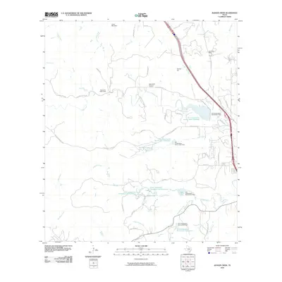
2010 Map of Ranger Creek
USGS Topo · Published 2010About this map
Cibolo Creek and its many tributaries, including Little Joshua Creek and Possum Creek, define the landscape of this Kendall County region. The topography is marked by significant elevations like Cedar Mountain and Cannon Hill, while water management is evident through a series of reservoirs and dams managed by the Soil Conservation Service. Local history is anchored by the Upper Cibolo Community Cemetery and early landmarks such as Spanish Pass and Comanche Spring. The map documents a blend of ranching heritage and modern development, with extensive road networks like Seven Eleven Ranch Rd and Tapatio Dr W connecting rural homesteads to recreation sites like Sycamore Ridge Camp. Private water features such as 711 Ranch Lake and the Smith Investment Company Lake Number 1 reflect the era's land use and property management.
Find a feature on this map
58 named features on this map. Tap any name to fly to it.
Don’t see what you’re looking for? This feature index may not catch every label — zoom into the map to look around manually.
Map Details
Editions of this 2010 Ranger Creek Map
This is the sole edition of this map. No revisions or reprints were ever made.
Other maps of this area

1953 · Van Raub
USGS Topo · 1:24,000

1954 · San Antonio
USGS Topo · 1:250,000

1956 · Comfort
USGS Topo · 1:62,500

1956 · Medina Lake
USGS Topo · 1:62,500

1957 · Boerne
USGS Topo · 1:62,500

1957 · San Antonio
USGS Topo · 1:250,000

1964 · Comfort
USGS Topo · 1:24,000

1964 · Waring
USGS Topo · 1:24,000

1964 · Sisterdale
USGS Topo · 1:24,000

1964 · Boerne
USGS Topo · 1:24,000