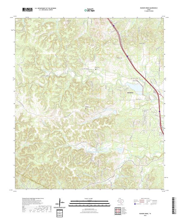
2022 Map of Ranger Creek
USGS Topo · Published 2022About this map
Boerne serves as the primary hub in this portion of the Texas Hill Country, where the landscape is defined by the winding course of Cibolo Cr and its many tributaries like Frederick Cr. The map highlights a complex hydrography of small ranch lakes and conservation reservoirs, including 711 Ranch Lake and Masters Lake, reflecting the region's managed water resources. Local heritage is preserved in sites such as the Upper Cibolo Community Cem and the Dantziger Monument Cem, while landmarks like Comanche Spring near Spanish Pass point to the area's long-standing natural importance. The terrain rises sharply to features like Cedar Mtn and Cannon Hill, with the road network following the contours of the limestone hills along routes like Upper Cibolo Creek Rd.
Find a feature on this map
85 named features on this map. Tap any name to fly to it.
Don’t see what you’re looking for? This feature index may not catch every label — zoom into the map to look around manually.
Map Details
Editions of this 2022 Ranger Creek Map
This is the sole edition of this map. No revisions or reprints were ever made.
Other maps of this area

1953 · Van Raub
USGS Topo · 1:24,000

1954 · San Antonio
USGS Topo · 1:250,000

1956 · Comfort
USGS Topo · 1:62,500

1956 · Medina Lake
USGS Topo · 1:62,500

1957 · Boerne
USGS Topo · 1:62,500

1957 · San Antonio
USGS Topo · 1:250,000

1964 · Comfort
USGS Topo · 1:24,000

1964 · Waring
USGS Topo · 1:24,000
1964 · Sisterdale
USGS Topo · 1:24,000

1964 · Boerne
USGS Topo · 1:24,000