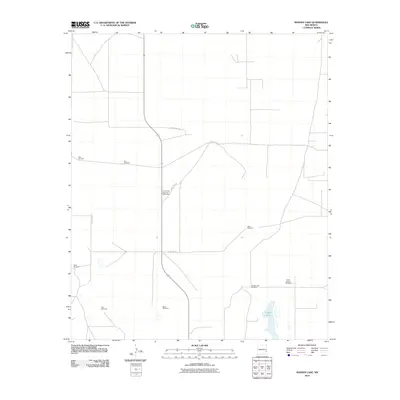
2010 Map of Ranger Lake
USGS Topo · Published 2010About this map
Ranger Lake defines the southeastern quadrant of this high-plains landscape in Lea County, representing one of the few natural catchments in an otherwise arid ranching territory. The distribution of infrastructure here is sparse, characterized by the functional necessities of water access and communication. Numerous named watering points, such as Bull Windmill, Mixon Windmill, and North Pasture Windmill, are scattered across the terrain, indicating a long-standing reliance on groundwater to support local livestock operations. A network of rural routes, including County Rd-165 and County Rd-182, connects these remote outposts. A significant landmark for regional navigation is the Crossroads Television Relay Mast, which stands as a prominent man-made feature amid the low-relief geography near the center of the survey area.
Find a feature on this map
13 named features on this map. Tap any name to fly to it.
Don’t see what you’re looking for? This feature index may not catch every label — zoom into the map to look around manually.
Map Details
Editions of this 2010 Ranger Lake Map
This is the sole edition of this map. No revisions or reprints were ever made.
Other maps of this area

1954 · Brownfield
USGS Topo · 1:250,000

1958 · Brownfield
USGS Topo · 1:250,000

1961 · Johnson Ranch
USGS Topo · 1:24,000

1962 · Brownfield
USGS Topo · 1:250,000

1970 · Walking Cane Ranch
USGS Topo · 1:24,000

1970 · Gladiola
USGS Topo · 1:24,000

1970 · Johnson Ranch
USGS Topo · 1:24,000

1970 · Simanola Valley
USGS Topo · 1:24,000

1970 · Ranger Lake
USGS Topo · 1:24,000

1970 · Tatum North
USGS Topo · 1:24,000