
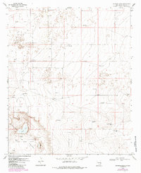
1970 Map of Johnson Ranch
USGS Topo · Published 1972About this map
Johnson Ranch and a sparse network of ranching infrastructure define this high plains landscape as it was documented in 1970. The terrain is punctuated by numerous named water resources vital for livestock, including the Sand Windmill, Lucky Windmill, and Jog Windmill. Toward the south, the Four Lakes Area reveals a more complex hydrology featuring North Lake, Middle Lake, and East Lake.
Find a feature on this map
24 named features on this map. Tap any name to fly to it.
Don’t see what you’re looking for? This feature index may not catch every label — zoom into the map to look around manually.
Map Details
Editions of this 1970 Johnson Ranch Map
2 editions found
Other maps of this area

1954 · Brownfield
USGS Topo · 1:250,000

1958 · Brownfield
USGS Topo · 1:250,000

1961 · Johnson Ranch
USGS Topo · 1:24,000

1962 · Brownfield
USGS Topo · 1:250,000

1970 · Simanola Valley
USGS Topo · 1:24,000

1970 · Ranger Lake
USGS Topo · 1:24,000

1970 · Tatum North
USGS Topo · 1:24,000

1972 · Milnesand SW
USGS Topo · 1:24,000

1972 · Crossroads
USGS Topo · 1:24,000
1973 · Lane Salt Lake
USGS Topo · 1:24,000