
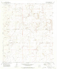
1972 Map of Crossroads
USGS Topo · Published 1975About this map
The high plains of eastern New Mexico are defined by extensive energy infrastructure on this 1970s survey, particularly where the Roosevelt Co and Lea Co lines meet. The small settlement of Crossroads sits near the southern edge of the map, serving as a hub for the surrounding extractive industries. The landscape is dominated by the Prairie Oil Field and Bough Oil Field, which are networked by an intricate system of pipelines, access roads, and numerous extraction sites marked as Oil Wells.
Find a feature on this map
14 named features on this map. Tap any name to fly to it.
Don’t see what you’re looking for? This feature index may not catch every label — zoom into the map to look around manually.
Map Details
Editions of this 1972 Crossroads Map
This is the sole edition of this map. No revisions or reprints were ever made.
Other maps of this area

1954 · Brownfield
USGS Topo · 1:250,000

1958 · Brownfield
USGS Topo · 1:250,000

1961 · Johnson Ranch
USGS Topo · 1:24,000

1962 · Brownfield
USGS Topo · 1:250,000

1970 · Walking Cane Ranch
USGS Topo · 1:24,000

1970 · Johnson Ranch
USGS Topo · 1:24,000

1970 · Ranger Lake
USGS Topo · 1:24,000

1972 · Milnesand SW
USGS Topo · 1:24,000

1972 · Bluit
USGS Topo · 1:24,000
1972 · Bledsoe SW
USGS Topo · 1:24,000