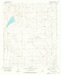
1973 Map of Lane Salt Lake
USGS Topo · Published 1976About this map
Lane Salt Lake dominates the western depression of this High Plains landscape, serving as a focal point for a region defined by its ranching history and mid-century energy development. The presence of the McGuffin Ranch and Lane Ranch suggests the established cattle operations of Lea County, supported by a network of water sources such as the Antelope Windmill, Baker Windmill, and Bull Windmill.
Find a feature on this map
28 named features on this map. Tap any name to fly to it.
Don’t see what you’re looking for? This feature index may not catch every label — zoom into the map to look around manually.
Map Details
Editions of this 1973 Lane Salt Lake Map
2 editions found
Other maps of this area

1954 · Brownfield
USGS Topo · 1:250,000

1958 · Brownfield
USGS Topo · 1:250,000

1961 · Johnson Ranch
USGS Topo · 1:24,000

1962 · Brownfield
USGS Topo · 1:250,000

1970 · Johnson Ranch
USGS Topo · 1:24,000

1970 · Simanola Valley
USGS Topo · 1:24,000

1972 · Milnesand SW
USGS Topo · 1:24,000

1973 · Soldier Hill
USGS Topo · 1:24,000

1973 · Caprock
USGS Topo · 1:24,000
1973 · Dallas Store
USGS Topo · 1:24,000