
1973 Map of Soldier Hill
USGS Topo · Published 1976About this map
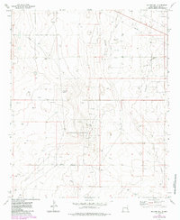
Soldier Hill rises from the high plains of Lea County, serving as a prominent landmark in a landscape defined by 1970s energy extraction. This 1973 survey details the extensive infrastructure of the Permian Basin, showing the dense network of wells and pipelines associated with the Bagley North Oil Field, Moore Oil Field, and Bagley West Oil Field. These oil fields dominate the eastern half of the map, while the western portion reveals more isolated ranching and rural activity.
Find a feature on this map
10 named features on this map. Tap any name to fly to it.
Don’t see what you’re looking for? This feature index may not catch every label — zoom into the map to look around manually.
Map Details
Editions of this 1973 Soldier Hill Map
2 editions found
Other maps of this area

1954 · Brownfield
USGS Topo · 1:250,000

1958 · Brownfield
USGS Topo · 1:250,000

1962 · Brownfield
USGS Topo · 1:250,000

1973 · Mescalero Point
USGS Topo · 1:24,000

1973 · Caprock
USGS Topo · 1:24,000

1973 · Caudill Ranch
USGS Topo · 1:24,000

1973 · Cooper-Good Ranch
USGS Topo · 1:24,000

1973 · Mescalero Point NE
USGS Topo · 1:24,000
1973 · Frier Ranch
USGS Topo · 1:24,000
1973 · Lane Salt Lake
USGS Topo · 1:24,000