
1973 Map of Cooper-Good Ranch
USGS Topo · Published 1976About this map
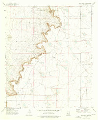
Caprock terrain dominates this corner of Lea County, where the high plains of New Mexico meet a landscape defined by 1970s energy extraction. The map reveals an intensive network of petroleum infrastructure, with numerous Oil Wells and a dense concentration of Drill Holes spread across the Caprock Oil Field and Baum North Oil Field. This industrial activity is superimposed over a traditional ranching environment, characterized by isolated homesteads and long-established property lines. The presence of the Cooper-Good Ranch, Price Ranch, and Tulk Ranch alongside a specialized Pumping Sta and an extensive Pipeline network illustrates the coexistence of the region's cattle-raising heritage and its mid-century oil boom. Surveyed in the early 1970s, the map provides a precise look at the rural road system and the scattered Gravel Pits that supported both ranching and drilling operations during this period.
Find a feature on this map
14 named features on this map. Tap any name to fly to it.
Don’t see what you’re looking for? This feature index may not catch every label — zoom into the map to look around manually.
Map Details
Editions of this 1973 Cooper-Good Ranch Map
This is the sole edition of this map. No revisions or reprints were ever made.
Other maps of this area

1954 · Brownfield
USGS Topo · 1:250,000

1958 · Brownfield
USGS Topo · 1:250,000

1962 · Brownfield
USGS Topo · 1:250,000

1973 · Mescalero Point
USGS Topo · 1:24,000

1973 · Fort Ranch
USGS Topo · 1:24,000

1973 · Soldier Hill
USGS Topo · 1:24,000

1973 · Caudill Ranch
USGS Topo · 1:24,000

1973 · Dean Ranch
USGS Topo · 1:24,000
1973 · Cedar Point SE
USGS Topo · 1:24,000
1973 · Frier Ranch
USGS Topo · 1:24,000