
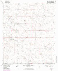
1973 Map of Dean Ranch
USGS Topo · Published 1976About this map
Tulk Oil Field dominates the central landscape of this western portion of Lea County, revealing an economy defined by petroleum extraction in the early 1970s. The land is marked by an extensive network of oil wells and numerous drill holes, indicating intensive exploration and production activity during this era. Amidst this industrial infrastructure, traditional cattle ranching persists at Dean Ranch and Good Ranch, which serve as the primary named residential anchors in an otherwise sparse high-plains environment. A single Gravel Pit and a web of pipelines further illustrate the specialized resource-based development of the region, where the flat terrain is crisscrossed by service roads supporting both the ranches and the oil industry.
Find a feature on this map
6 named features on this map. Tap any name to fly to it.
Don’t see what you’re looking for? This feature index may not catch every label — zoom into the map to look around manually.
Map Details
Editions of this 1973 Dean Ranch Map
2 editions found
Other maps of this area

1954 · Hobbs
USGS Topo · 1:250,000

1954 · Brownfield
USGS Topo · 1:250,000

1958 · Brownfield
USGS Topo · 1:250,000

1958 · Hobbs
USGS Topo · 1:250,000

1962 · Brownfield
USGS Topo · 1:250,000

1962 · Buckeye
USGS Topo · 1:62,500

1963 · Maljamar
USGS Topo · 1:62,500

1973 · Fort Ranch
USGS Topo · 1:24,000

1973 · Caudill Ranch
USGS Topo · 1:24,000

1973 · Cooper-Good Ranch
USGS Topo · 1:24,000