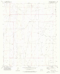
1973 Map of Frier Ranch
USGS Topo · Published 1976About this map
Frier Ranch and Roach Ranch anchor this West Texas landscape during a period of significant energy development in Lea County. The terrain is defined by the expansive footprints of the Hightower East Oil Field, Lazy J Oil Field, and Cerca Oil Field, reflecting the industrial character of the region in the early 1970s. A complex network of pipelines and unimproved roads connects numerous drill holes and wells, illustrating the intensive extraction efforts of the era. Interspersed among these industrial features are several Gravel Pits and a local Substa, highlighting the infrastructure required to support these operations. This survey provides a precise look at the intersection of traditional ranching land and the burgeoning oil economy in the High Plains.
Find a feature on this map
7 named features on this map. Tap any name to fly to it.
Don’t see what you’re looking for? This feature index may not catch every label — zoom into the map to look around manually.
Map Details
Editions of this 1973 Frier Ranch Map
This is the sole edition of this map. No revisions or reprints were ever made.
Other maps of this area

1954 · Brownfield
USGS Topo · 1:250,000

1958 · Brownfield
USGS Topo · 1:250,000

1962 · Brownfield
USGS Topo · 1:250,000

1970 · Simanola Valley
USGS Topo · 1:24,000

1970 · Alston Ranch
USGS Topo · 1:24,000

1970 · Hillburn City SW
USGS Topo · 1:24,000

1973 · Fort Ranch
USGS Topo · 1:24,000

1973 · Soldier Hill
USGS Topo · 1:24,000

1973 · Cooper-Good Ranch
USGS Topo · 1:24,000

1973 · Dean Ranch
USGS Topo · 1:24,000