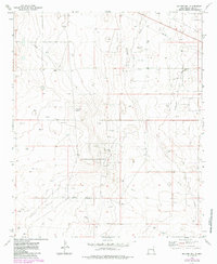
1973 Map of Soldier Hill
USGS Topo · Published 1985About this map
Soldier Hill rises above a landscape dominated by the mid-century petroleum industry in this part of eastern New Mexico. The terrain is marked by a high density of industrial sites, including the Bagley North Oil Field, Moore Oil Field, and Bagley West Oil Field. These fields create a grid of wells and service roads across the Llano Estacado, illustrating the intensive extraction efforts of the era.
Find a feature on this map
17 named features on this map. Tap any name to fly to it.
Don’t see what you’re looking for? This feature index may not catch every label — zoom into the map to look around manually.
Map Details
Editions of this 1973 Soldier Hill Map
2 editions found
Other maps of this area

1954 · Brownfield
USGS Topo · 1:250,000

1958 · Brownfield
USGS Topo · 1:250,000

1962 · Brownfield
USGS Topo · 1:250,000

1973 · Mescalero Point
USGS Topo · 1:24,000

1973 · Soldier Hill
USGS Topo · 1:24,000

1973 · Caprock
USGS Topo · 1:24,000

1973 · Caudill Ranch
USGS Topo · 1:24,000

1973 · Cooper-Good Ranch
USGS Topo · 1:24,000

1973 · Mescalero Point NE
USGS Topo · 1:24,000
1973 · Frier Ranch
USGS Topo · 1:24,000