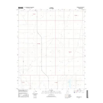
2017 Map of Ranger Lake
USGS Topo · Published 2017About this map
Ranger Lake serves as a primary geographical anchor in this corner of Lea County, characterized by the expansive grazing lands and section-line road networks typical of the High Plains. The landscape is defined by its meticulous division into townships and ranges, such as t10s r35e and t9s r36e, which organize the rural territory into a systematic grid. Local travel is facilitated by named thoroughfares like Kinsolving Ln and Peveler Rd, reflecting the enduring footprint of ranching families and early landowners in this part of New Mexico. The presence of Co Rd 165 and Johnson Rd further highlights the local connectivity between isolated homesteads and larger regional corridors, providing a detailed look at the rural infrastructure in the early twenty-first century.
Find a feature on this map
11 named features on this map. Tap any name to fly to it.
Don’t see what you’re looking for? This feature index may not catch every label — zoom into the map to look around manually.
Map Details
Editions of this 2017 Ranger Lake Map
This is the sole edition of this map. No revisions or reprints were ever made.
Other maps of this area

1954 · Brownfield
USGS Topo · 1:250,000

1958 · Brownfield
USGS Topo · 1:250,000

1961 · Johnson Ranch
USGS Topo · 1:24,000

1962 · Brownfield
USGS Topo · 1:250,000

1970 · Walking Cane Ranch
USGS Topo · 1:24,000

1970 · Gladiola
USGS Topo · 1:24,000

1970 · Johnson Ranch
USGS Topo · 1:24,000

1970 · Simanola Valley
USGS Topo · 1:24,000

1970 · Ranger Lake
USGS Topo · 1:24,000

1970 · Tatum North
USGS Topo · 1:24,000