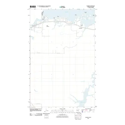
2010 Map of Ranier
USGS Topo · Published 2010About this map
Ranier sits at the northern edge of this Minnesota landscape, positioned where Rainy Lake flows into the Rainy River along the international border. The local infrastructure of the early twenty-first century is defined by a network of county roads and the presence of the Ranier Post Office, serving the border community. To the east, the watery expanse of the lake is broken by Enos Island, Roberts Island, and Prues Island, while shoreline features like Ogard Point and High Rock Point mark the transition from land to water.
Find a feature on this map
26 named features on this map. Tap any name to fly to it.
Don’t see what you’re looking for? This feature index may not catch every label — zoom into the map to look around manually.
Map Details
Editions of this 2010 Ranier Map
This is the sole edition of this map. No revisions or reprints were ever made.
Other maps of this area

1919 · International Falls
USGS Topo · 1:62,500

1954 · International Falls
USGS Topo · 1:250,000

1957 · International Falls
USGS Topo · 1:250,000

1958 · International Falls
USGS Topo · 1:250,000

1963 · Ranier
USGS Topo · 1:24,000

1969 · Island View
USGS Topo · 1:24,000

1969 · Ericsburg NW
USGS Topo · 1:24,000

1969 · Ericsburg
USGS Topo · 1:24,000

1969 · Ray
USGS Topo · 1:24,000

1969 · Ranier
USGS Topo · 1:24,000