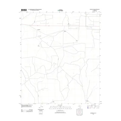
2012 Map of Rankin NE
USGS Topo · Published 2012About this map
Flat Rock Ranch and the surrounding rangeland of Upton County characterize this West Texas landscape in the early 21st century. The map centers on the high-desert terrain near Flat Rock, where the local economy is defined by a blend of traditional ranching and industrial energy extraction. The Flat Rock Oil Field occupies the northern reaches of the quadrangle, interspersed with a critical network of water infrastructure. Numerous named wells and pumps, including the Railroad Windmill, South Windmill, and East Windmill, are scattered across the plains to support livestock. Transportation is limited to a sparse grid of county roads such as Co RD-220 and Co RD-225, which navigate the subtle shifts in elevation that define this portion of the Permian Basin region.
Find a feature on this map
11 named features on this map. Tap any name to fly to it.
Don’t see what you’re looking for? This feature index may not catch every label — zoom into the map to look around manually.
Map Details
Editions of this 2012 Rankin NE Map
This is the sole edition of this map. No revisions or reprints were ever made.
Other maps of this area

1928 · Rankin
USGS Topo · 1:125,000

1954 · San Angelo
USGS Topo · 1:250,000

1958 · San Angelo
USGS Topo · 1:250,000

1965 · San Angelo
USGS Topo · 1:250,000

1970 · Sevenmile Corner SE
USGS Topo · 1:24,000
1970 · Rankin SE
USGS Topo · 1:24,000
1970 · Cedar Canyon
USGS Topo · 1:24,000

1970 · Sevenmile Corner
USGS Topo · 1:24,000
1970 · Rankin NE
USGS Topo · 1:24,000

1970 · Garrison Draw
USGS Topo · 1:24,000