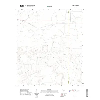
2019 Map of Rankin NE
USGS Topo · Published 2019About this map
Rankin Draw meanders across this West Texas landscape, defining the primary drainage pattern of the high plateau region. This area, located along the shared boundary of Upton Co and Reagan Co, is characterized by its wide-open spaces and the transition from flat tablelands to more complex topographic breaks in the southern half of the quadrangle. The road network is sparse and utilitarian, centered on the east-west corridor of 67. Local travel is facilitated by unpaved county routes including Co Rd 230, Co Rd 225, and Co Rd 220. This map illustrates the intersection of geography and county administration in a region where land use is dictated by the availability of water and the orientation of the natural draws.
Find a feature on this map
6 named features on this map. Tap any name to fly to it.
Don’t see what you’re looking for? This feature index may not catch every label — zoom into the map to look around manually.
Map Details
Editions of this 2019 Rankin NE Map
This is the sole edition of this map. No revisions or reprints were ever made.
Other maps of this area

1928 · Rankin
USGS Topo · 1:125,000

1954 · San Angelo
USGS Topo · 1:250,000

1958 · San Angelo
USGS Topo · 1:250,000

1965 · San Angelo
USGS Topo · 1:250,000

1970 · Sevenmile Corner SE
USGS Topo · 1:24,000
1970 · Rankin SE
USGS Topo · 1:24,000
1970 · Cedar Canyon
USGS Topo · 1:24,000

1970 · Sevenmile Corner
USGS Topo · 1:24,000
1970 · Rankin NE
USGS Topo · 1:24,000

1970 · Garrison Draw
USGS Topo · 1:24,000