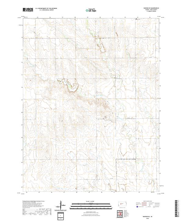
2022 Map of Ransom SE
USGS Topo · Published 2022About this map
Vansburgh Cem serves as a lone cultural landmark in this stretch of Ness County, situated near the northern border where the terrain begins its subtle drainage toward the Smoky Hill River valley to the north. The landscape is defined by the ephemeral winding of Bazine Dry Cr and its tributary Long Br, which carve shallow paths through the high plains. The rigid geometry of the Public Land Survey System is clearly visible, with section lines reflected in the rural road network including E 240 Rd and E 230 Rd. This map captures a quintessential Western Kansas agricultural environment, where the infrastructure of Township 17 South is organized around these seasonal watercourses and gravel section-line roads.
Find a feature on this map
14 named features on this map. Tap any name to fly to it.
Don’t see what you’re looking for? This feature index may not catch every label — zoom into the map to look around manually.
Map Details
Editions of this 2022 Ransom SE Map
This is the sole edition of this map. No revisions or reprints were ever made.
Other maps of this area

1892 · Ness
USGS Topo · 1:125,000

1893 · Ellis
USGS Topo · 1:125,000

1894 · Ness
USGS Topo · 1:125,000

1955 · Great Bend
USGS Topo · 1:250,000

1957 · Great Bend
USGS Topo · 1:250,000

1958 · Great Bend
USGS Topo · 1:250,000

1966 · Ransom SE
USGS Topo · 1:24,000

1966 · Mc Cracken SW
USGS Topo · 1:24,000

1966 · Ness City
USGS Topo · 1:24,000

1966 · Ness City NE
USGS Topo · 1:24,000