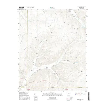
2016 Map of Ransom Stand
USGS Topo · Published 2016About this map
Ransom Stand sits at the heart of this dissected plateau region where the borders of Tennessee and Alabama meet. The landscape is defined by an intricate network of hollows and ridges, including McFalls Ridge and Bevis Ridge, which have historically dictated the placement of settlements and transit routes. Small family and community cemeteries are scattered throughout the drainages of Horse Cr and Second Cr, such as Stribling Cem and the Old Baptist Cem, providing a detailed record of the area's rural genealogy. The map captures the transition from Hardin County into Lauderdale County, Alabama, showing how local roads like Bevis Ridge Rd and Tally Branch Rd follow the natural topography. This 2016 data illustrates a deeply rural community where place names like Patsy Hollow and Lige Hollow preserve the local history of the people who settled these secluded valleys.
Find a feature on this map
77 named features on this map. Tap any name to fly to it.
Don’t see what you’re looking for? This feature index may not catch every label — zoom into the map to look around manually.
Map Details
Editions of this 2016 Ransom Stand Map
This is the sole edition of this map. No revisions or reprints were ever made.
Other maps of this area

1905 · Waynesboro
USGS Topo · 1:125,000

1911 · Iuka
USGS Topo · 1:48,000

1914 · Iuka
USGS Topo · 1:62,500

1924 · Gravelly Springs
USGS Topo · 1:48,000

1926 · Gravelly Springs
USGS Topo · 1:62,500

1935 · Wright
USGS Topo · 1:24,000

1936 · Wolf Pit Ridge
USGS Topo · 1:24,000

1936 · Waterloo
USGS Topo · 1:24,000

1936 · Threet
USGS Topo · 1:24,000

1936 · Cypress Inn
USGS Topo · 1:24,000