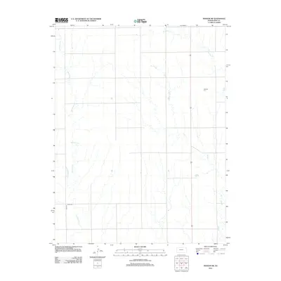
2012 Map of Ransom SW
USGS Topo · Published 2012About this map
Bazine Dry Cr and Wild Horse Cr define the hydrological character of this Ness County landscape, where the High Plains terrain is etched by seasonal drainage patterns. This 2012 survey documents a rural environment predominantly defined by its Section Line roads and agricultural infrastructure, with US Highway 283 serving as the primary north-south corridor. Genealogical and local history interest is concentrated at Dagenett Cem in the northeast and N Star Cem along Co Rd 533 in the southwest. These isolated burial grounds, along with the intermittent flows of Long Br and Forrester Cr, provide the primary landmarks in an area where the grid-work of ranch roads and township lines remains the dominant human imprint on the land.
Find a feature on this map
8 named features on this map. Tap any name to fly to it.
Don’t see what you’re looking for? This feature index may not catch every label — zoom into the map to look around manually.
Map Details
Editions of this 2012 Ransom SW Map
This is the sole edition of this map. No revisions or reprints were ever made.
Other maps of this area

1892 · Ness
USGS Topo · 1:125,000

1893 · Ellis
USGS Topo · 1:125,000

1894 · Ness
USGS Topo · 1:125,000

1955 · Great Bend
USGS Topo · 1:250,000

1955 · Scott City
USGS Topo · 1:250,000

1957 · Great Bend
USGS Topo · 1:250,000

1958 · Great Bend
USGS Topo · 1:250,000

1958 · Scott City
USGS Topo · 1:250,000

1966 · Ransom SE
USGS Topo · 1:24,000

1966 · Ness City
USGS Topo · 1:24,000