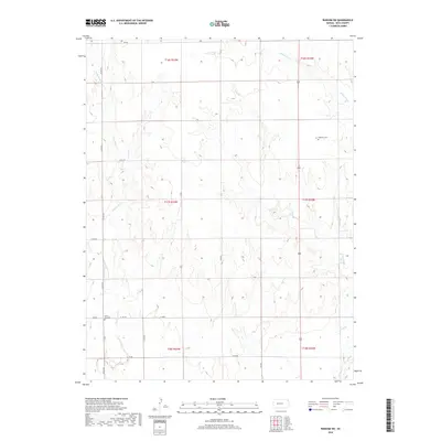
2018 Map of Ransom SW
USGS Topo · Published 2018About this map
Dagenett Cem and North Star Cem provide significant touchpoints for genealogists researching family ties in this rural section of Ness County. The landscape is defined by its drainage network, where intermittent waterways like Wild Horse Cr, Long Br, and Buzine Dry Cr carve subtle variations into the terrain. In the southwest corner, Forrester Cr serves as another key landmark for identifying historic landholdings. A rigid grid of section-line roads, including Co RD 533 and W 180 RD, organizes the agricultural landscape, illustrating the enduring influence of the Public Land Survey System on Kansas settlement patterns.
Find a feature on this map
25 named features on this map. Tap any name to fly to it.
Don’t see what you’re looking for? This feature index may not catch every label — zoom into the map to look around manually.
Map Details
Editions of this 2018 Ransom SW Map
This is the sole edition of this map. No revisions or reprints were ever made.
Other maps of this area

1892 · Ness
USGS Topo · 1:125,000

1893 · Ellis
USGS Topo · 1:125,000

1894 · Ness
USGS Topo · 1:125,000

1955 · Great Bend
USGS Topo · 1:250,000

1955 · Scott City
USGS Topo · 1:250,000

1957 · Great Bend
USGS Topo · 1:250,000

1958 · Great Bend
USGS Topo · 1:250,000

1958 · Scott City
USGS Topo · 1:250,000

1966 · Ransom SE
USGS Topo · 1:24,000

1966 · Ness City
USGS Topo · 1:24,000