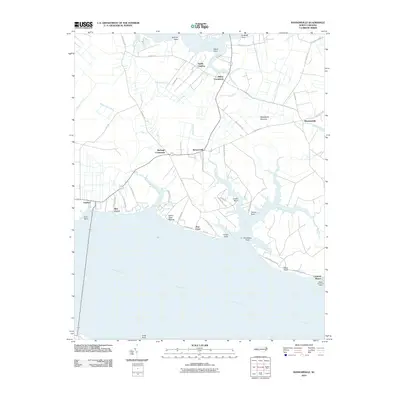
2010 Map of Ransomville
USGS Topo · Published 2010About this map
Pungo Creek and the wide reaches of the Pamlico River dominate this coastal landscape, where the water has shaped both the economy and the settlement patterns of Beaufort County. Along the northern shoreline, points of land like Sullivan Point, Ward Point, and Archbell Point reach into the creek, while the southern coast is dotted with riverside communities including Island View Shores, Pine Crest, and Rest Haven. Inland, the map reveals a network of small crossroads and rural centers such as Sidney Crossroads and Burbage Crossroads, which served as the focal points for the surrounding agricultural tracts. The eastern edge features the Woodstock Savanna, reflecting the unique coastal ecology of the region. Near the river's edge, the Wades Point Post Office at Cockrell Beach stands as a significant local landmark for genealogists tracing family ties to the maritime and postal history of this riverfront district.
Find a feature on this map
63 named features on this map. Tap any name to fly to it.
Don’t see what you’re looking for? This feature index may not catch every label — zoom into the map to look around manually.
Map Details
Editions of this 2010 Ransomville Map
This is the sole edition of this map. No revisions or reprints were ever made.
Other maps of this area

1914 · Belhaven
USGS Topo · 1:48,000

1916 · Belhaven
USGS Topo · 1:62,500

1943 · Plymouth
USGS Topo · 1:125,000

1950 · Lowland
USGS Topo · 1:24,000

1950 · South Creek
USGS Topo · 1:24,000

1950 · Pinetown
USGS Topo · 1:24,000

1950 · Aurora
USGS Topo · 1:24,000

1951 · Bath
USGS Topo · 1:24,000

1951 · Ransomville
USGS Topo · 1:24,000

1951 · Pamlico Beach
USGS Topo · 1:24,000