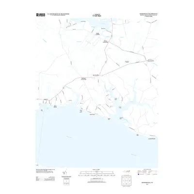
2013 Map of Ransomville
USGS Topo · Published 2013About this map
Ransomville and the surrounding coastal communities of Beaufort County occupy a landscape defined by the expansive Pamlico River and its intricate network of creeks and guts. This 2013 survey illustrates a quiet transition from the agricultural interior, marked by junctions like Burbage Crossroads and Sidney Crossroads, to the residential and recreational shoreline developments of Island View Shores and Rest Haven. Along the northern reaches of the river, numerous points of land such as Cousin Point and Chambers Point extend into the water, framing small inlets like Gaylord Bay. The presence of the Woodstock Savanna indicates a commitment to preserving the region's natural pine savanna ecosystems amidst the scattered settlements. For those interested in the area's maritime layout, the map details the complex hydrography of Pungo Cr and Jack Cr, which historically facilitated local transport and fishing long before the modern road networks of NC-1735 and NC-1718 were fully established.
Find a feature on this map
90 named features on this map. Tap any name to fly to it.
Don’t see what you’re looking for? This feature index may not catch every label — zoom into the map to look around manually.
Map Details
Editions of this 2013 Ransomville Map
This is the sole edition of this map. No revisions or reprints were ever made.
Other maps of this area

1914 · Belhaven
USGS Topo · 1:48,000

1916 · Belhaven
USGS Topo · 1:62,500

1943 · Plymouth
USGS Topo · 1:125,000

1950 · Lowland
USGS Topo · 1:24,000

1950 · South Creek
USGS Topo · 1:24,000

1950 · Pinetown
USGS Topo · 1:24,000

1950 · Aurora
USGS Topo · 1:24,000

1951 · Bath
USGS Topo · 1:24,000

1951 · Ransomville
USGS Topo · 1:24,000

1951 · Pamlico Beach
USGS Topo · 1:24,000