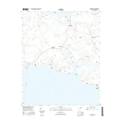
2016 Map of Ransomville
USGS Topo · Published 2016About this map
Woodstock Savanna and the low-lying wetlands of eastern Beaufort County define this coastal landscape along the north shore of the Pamlico River. The map details a transition from the agricultural interior, centered around hubs like Sidney Crossroads and Ransomville, to the intricate shoreline of the Gaylord Bay and Masons Harbor. Small waterfront residential communities and landings, including Island View Shores, Rest Haven, and Pine Crest, dot the southern coast, reflecting a longstanding reliance on the river. The northeastern portion of the sheet shows the dispersed settlements of Winsteadville and Burbage Crossroads, where drainage features like Old Mill Cr and Jack Cr carve through the flat coastal plain. Genealogists and local historians can trace the network of rural roads, such as Yeatesville Rd and Schoolhouse Rd, that connect these hamlets to the prominent points and necks extending into the brackish waters.
Find a feature on this map
90 named features on this map. Tap any name to fly to it.
Don’t see what you’re looking for? This feature index may not catch every label — zoom into the map to look around manually.
Map Details
Editions of this 2016 Ransomville Map
This is the sole edition of this map. No revisions or reprints were ever made.
Other maps of this area

1914 · Belhaven
USGS Topo · 1:48,000

1916 · Belhaven
USGS Topo · 1:62,500

1943 · Plymouth
USGS Topo · 1:125,000

1950 · Lowland
USGS Topo · 1:24,000

1950 · South Creek
USGS Topo · 1:24,000

1950 · Pinetown
USGS Topo · 1:24,000

1950 · Aurora
USGS Topo · 1:24,000

1951 · Bath
USGS Topo · 1:24,000

1951 · Ransomville
USGS Topo · 1:24,000

1951 · Pamlico Beach
USGS Topo · 1:24,000