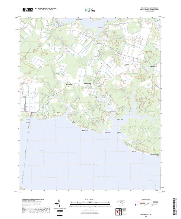
2022 Map of Ransomville
USGS Topo · Published 2022About this map
Ransomville and the surrounding crossroads communities of Beaufort County anchor this coastal landscape where the Pamlico River meets a network of creeks and marshes. The transition from timbered tracts like the Woodstock Savanna to the estuarine edges of Rumley Marsh defines the local geography. Small settlements and residential landings such as Island View Shores, Rest Haven, and Pine Crest are concentrated along the jagged northern shore of the river, linked by a rural road network that follows the higher ground between drainage points like Burbage Gut and Saint Clair Creek.
Find a feature on this map
87 named features on this map. Tap any name to fly to it.
Don’t see what you’re looking for? This feature index may not catch every label — zoom into the map to look around manually.
Map Details
Editions of this 2022 Ransomville Map
This is the sole edition of this map. No revisions or reprints were ever made.
Other maps of this area

1914 · Belhaven
USGS Topo · 1:48,000

1916 · Belhaven
USGS Topo · 1:62,500

1943 · Plymouth
USGS Topo · 1:125,000

1950 · Lowland
USGS Topo · 1:24,000

1950 · South Creek
USGS Topo · 1:24,000

1950 · Pinetown
USGS Topo · 1:24,000

1950 · Aurora
USGS Topo · 1:24,000

1951 · Bath
USGS Topo · 1:24,000

1951 · Ransomville
USGS Topo · 1:24,000

1951 · Pamlico Beach
USGS Topo · 1:24,000