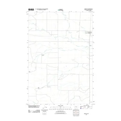
2011 Map of Rapelje
USGS Topo · Published 2011About this map
Rapelje serves as the primary hub for this portion of Stillwater County, concentrated around the intersection of Main St and 3rd St. The settlement is supported by essential local infrastructure, including the Rapelje Post Office and the Rapelje Vol Fire Company, while the Rapelje Cemetery lies just to the south. The surrounding landscape is defined by a series of parallel watercourses flowing eastward, including Sixshooter Creek, Middle Creek, and Cedar Creek.
Find a feature on this map
32 named features on this map. Tap any name to fly to it.
Don’t see what you’re looking for? This feature index may not catch every label — zoom into the map to look around manually.
Map Details
Editions of this 2011 Rapelje Map
This is the sole edition of this map. No revisions or reprints were ever made.
Other maps of this area

1889 · Big Snowy Mountain
USGS Topo · 1:250,000

1892 · Stillwater
USGS Topo · 1:125,000

1893 · Big Snowy Mountain
USGS Topo · 1:250,000

1954 · Billings
USGS Topo · 1:250,000

1954 · Roundup
USGS Topo · 1:250,000

1955 · Antelope Point
USGS Topo · 1:24,000

1955 · Russell Gulch
USGS Topo · 1:24,000

1956 · Rapelje
USGS Topo · 1:24,000

1956 · Battle Butte
USGS Topo · 1:24,000

1956 · Lindemulder Hill
USGS Topo · 1:24,000